Software
OzoneratesLanguage: Python | |
|---|---|
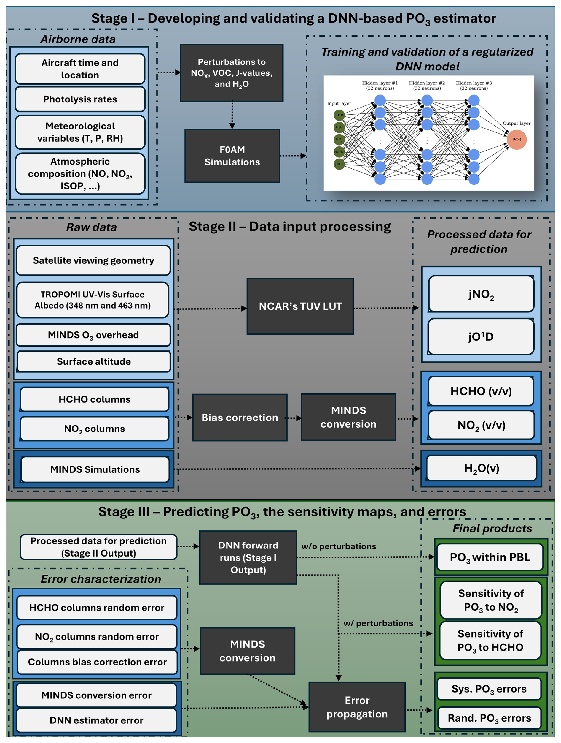 | I developed an object-oriented software that can process OMI/TROPOMI/TEMPO level-2 products and predict PO3 along with its sensitivity to NO2 and HCHO over a defined region and grid size. shortcut: pip install git+https://github.com/ahsouri/ozonerates |
OI-SAT-GMILanguage: Python | |
|---|---|
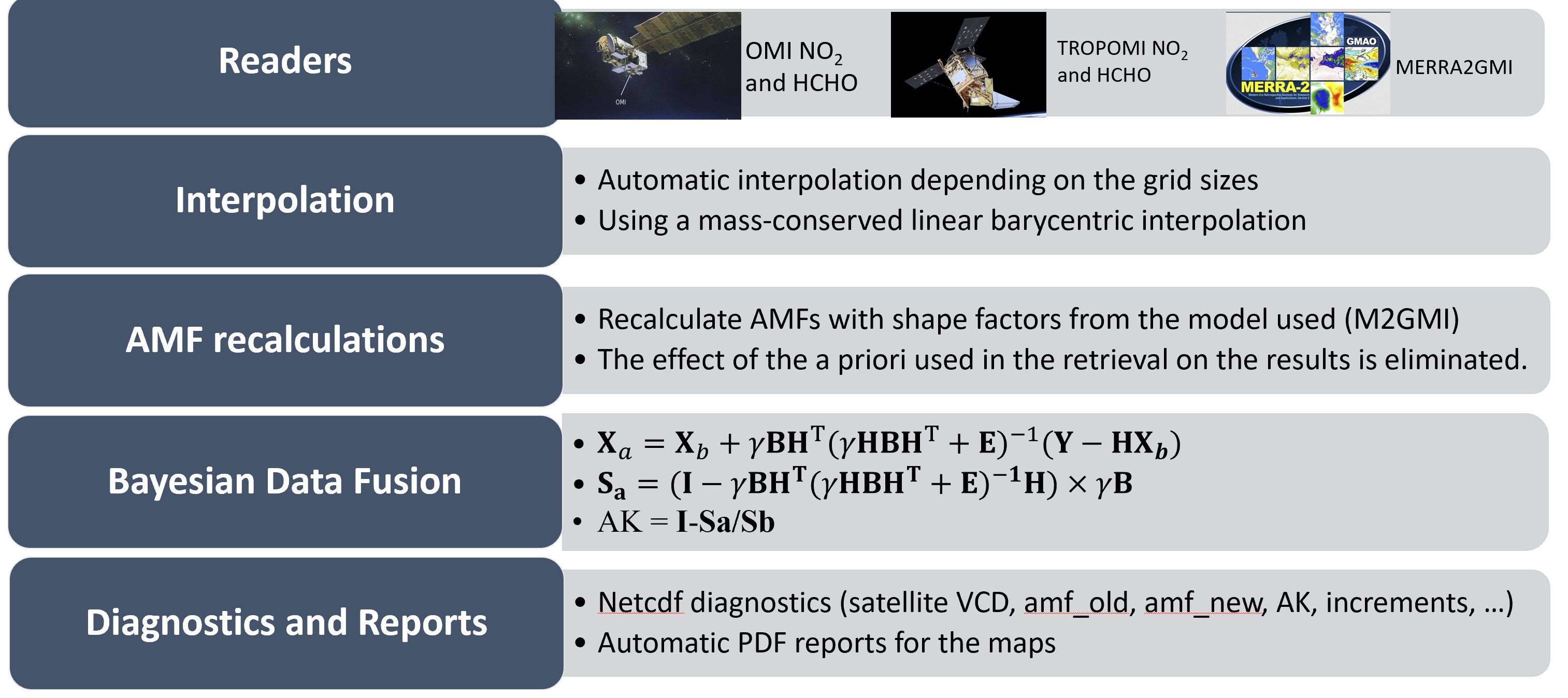 | I developed an object-oriented software that can download and process OMI/TROPOMI/MOPITT/OMPS/SSMIS level-2 products, perform air mass factor (AMF) recalculation, and conduct mass-conserved interpolation while also executing the a Bayesian data fusion algorithm (optimal interpolation). shortcut: pip install git+https://github.com/ahsouri/OI-SAT-GMI.git |
GEOAkazeLanguage: Python | |
|---|---|
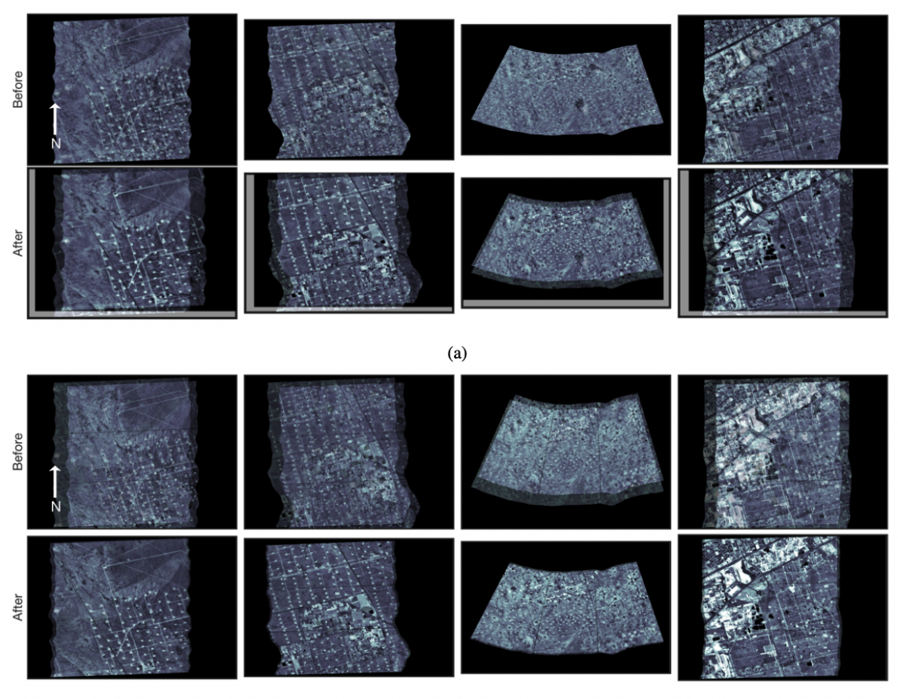 | I developed a computer vision algorithm that can automatically register two images (one with a better geolocation accuracy) to reduce geolocation errors in the less accurate image. shortcut: pip install git+https://github.com/ahsouri/GEOAkaze.git |
STREETLanguage: Python | |
|---|---|
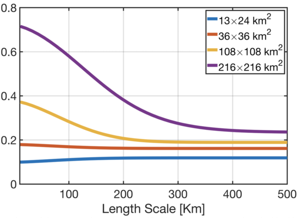 | Do you need to quantify the amount of information lost due to satellite footprints or model grid boxed or unresolved inputs/processes in retrieval algorithms/model schemes with respect to a reference? Use my package called SpaTial Representation Error EstimaTor (STREET): shortcut: pip install git+https://github.com/ahsouri/STREET |
demalosLanguage: Python | |
|---|---|
 | For many different applications including weather forecast modeling, or satellite retrievals, we are required to provide digital elevation maps at high resolution spatial resolution covering the whole globe. My toolbox will automatically download ALOS DEM at 30 m and save the subset of the data, depending on the boundary box defined by the user, into geotiff and netcdf formats. shortcut: pip install demalos |
GOESVisualizerLanguage: Python | |
|---|---|
 | It is sometimes useful to visualize the #GOES16/17 RGB imagery over your region/time of interest without having to pre-download the files. This simple toolbox will do the job. shortcut: pip install GOESVisualizer |
MSATwtdenoiserLanguage: Python | |
|---|---|
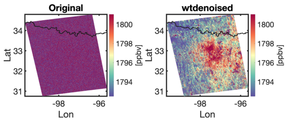 | Can you guess what the left panel is showing? It's XCH4 retrieved from the synthetic MethaneSAT data over Barnett. The plume is completely buried by noise despite SNR~200 as XCH4 is extremely sensitive to the radiance accuracy. The right panel uses a wavelet to denoise it. The same method can be applied to other noisy images (such as CHOCHO, HCHO, and SO2). shortcut: pip install MSATwtdenoiser |